The Decapolis | by Shelley Johnson
Shelley Johnson shares her insights and experiences about the Decapolis, the region of the "Ten Cities" mentioned in the Gospels.
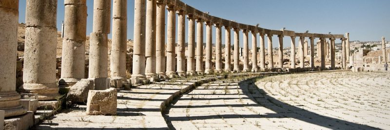
(Post image: Jerash in modern-day Jordan. Jerash was biblical Geresa.)
On the last night of our Holy Land trip in 2014, our guide sat us down for a wrap-up, sending us off with these words, “The pilgrimage is never over! Many times you’ll read the Bible and come across the name of a place you visited, and you’ll remember.” So, when I read the name, “Decapolis” in Mark 5, I pause.
And I remember.
Because I’ve been there, I can picture its Roman columns and amphitheater. I recall the contrast of its more advanced roads and architecture compared to other ancient sites we’d seen. The place stands out, so I’d love to share a little of what I learned and experienced that day in one of the cities of Decapolis.
But First, Maps
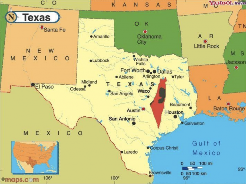
One of the things that surprised me most about Israel is its size–so small! As a Texas/Oklahoma girl who has had to drive hours to get from one city to the next, I was amazed how near the Mediterranean coast is to everything or how Bethlehem is minutes from Jerusalem. So, I have become quite the map fanatic.
Here’s a great visual to give you an idea of the size of Israel:
As we zoom in, we’ll see Israel as it is currently mapped out. Make note of three topography landmarks that become central in navigating the country and the stories of the Bible. 1) In the northern portion of Israel find the Sea of Galilee. 2) Then, trace the blue line heading south flowing out of the Sea of Galilee–the Jordan River. 3) It empties into our third body of water, the Dead Sea.
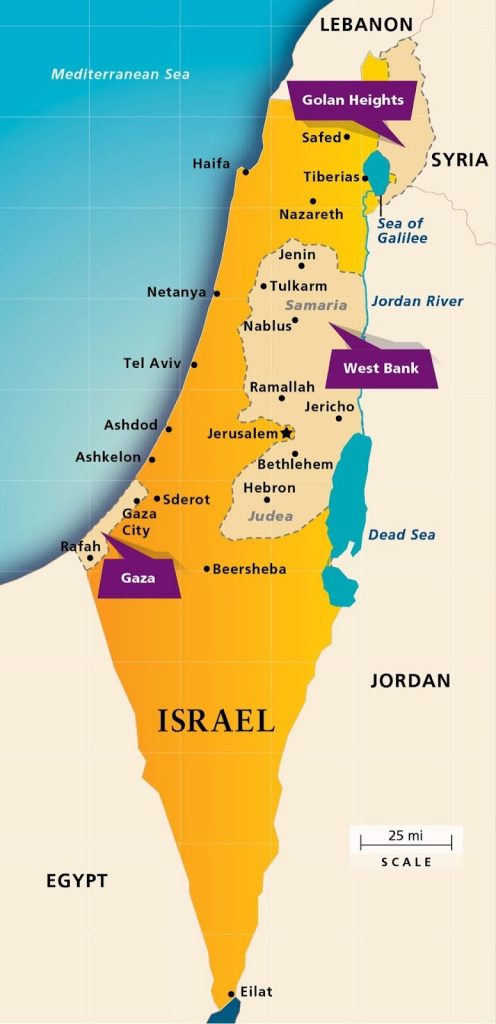
When we can visualize these three bodies of water, we are better able to picture the places Jesus and the apostles travel. For instance, Jesus and His disciples are from Galilee, so imagine them living in the area along the northern and western shores of the Sea of Galilee.
In relation to our Mark readings, Jesus would have been teaching along the northern banks of the Sea of Galilee near Capernaum (Mark 3-4), which you can see in red on the map below. Then the night of the storm at “sea,” the disciples would have been rowing across the Sea of Galilee from that northern tip toward the western shores, a Gentile region called Decapolis.
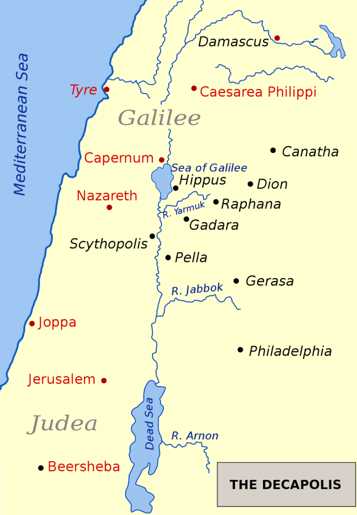
Jimmy gives a great explanation of the geography and history of this area on the podcast episode for Mark 5, and he points out that we don’t really know exactly where Jesus lands that night. But in Mark 5:20, we’re told, generally, He is in the Decapolis area. If you were to draw a line, a kind of half circle, encompassing all ten cities in black (above), that is the region known as Decapolis, which in Greek means “ten cities.”
Except for Scythopolis, the rest of the cities lie on the east side of the Jordan River. Today, Scythopolis remains in Israel’s boundaries and has taken on its original Hebrew name, Beth Shean.
Beth Shean
A second thing that stood out to me as our group traveled from place to place is how old everything is. In Texas or Oklahoma, things seem ancient if they’re over one hundred years old. But in Israel, we walked through cities and excavation sites that were thousands of years old.
Beth Shean is the Decapolis city our tour group saw in 2014. So, while it’s not the city Jesus would have been in when He cast out Legion into the pigs, it would have been similar in architecture, style, and feel. Beth Shean is SIX thousand years old. In fact, archeologists have excavated about twenty layers under Beth Shean, each layer representing a civilization (they call this kind of site a “tel”). So, the area of Beth Shean has been occupied since the Stone Age!
As a city of the Decapolis, Beth Shean was built by Pompey and the Romans in 63 BC, renaming it Scythopolis, meaning city of Scythians (ref: Colossians 3:11). The city thrived and grew till a huge earthquake hit in 749 AD. It seems the city was abandoned for fear of other earthquakes occurring. As a result, the city remains as it was left, so as archeologists have uncovered that top layer, what has been revealed is breathtaking.
Pictures rarely capture such experiences, but here are two photos of our first stop in Beth Shean, the theater:
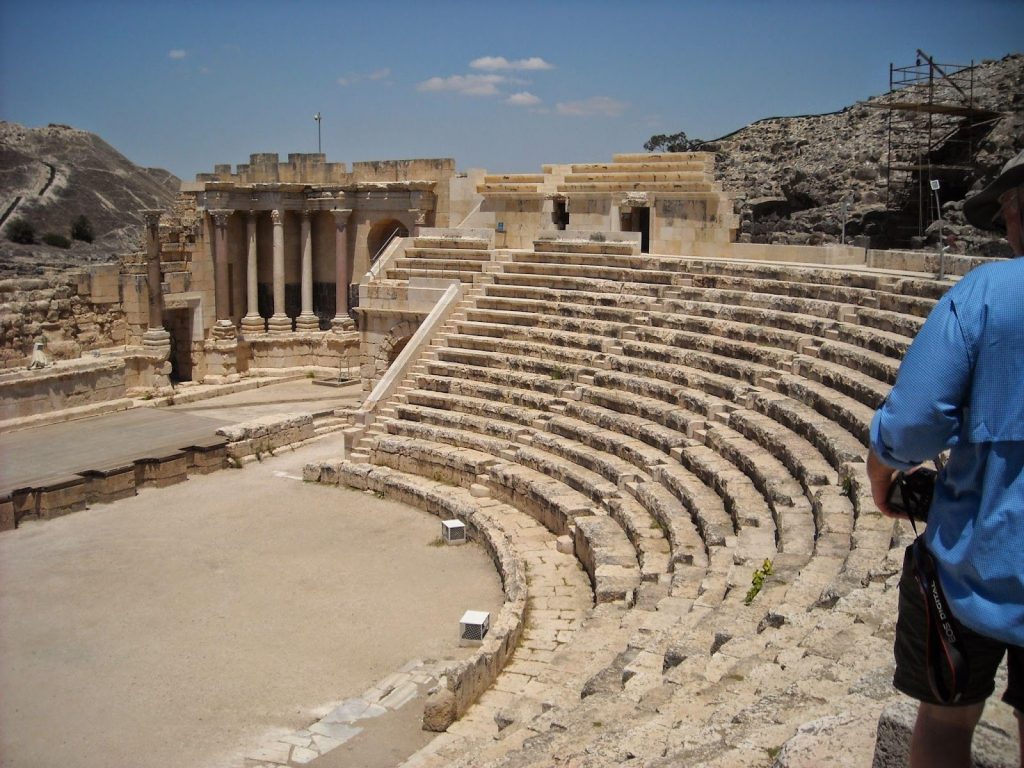
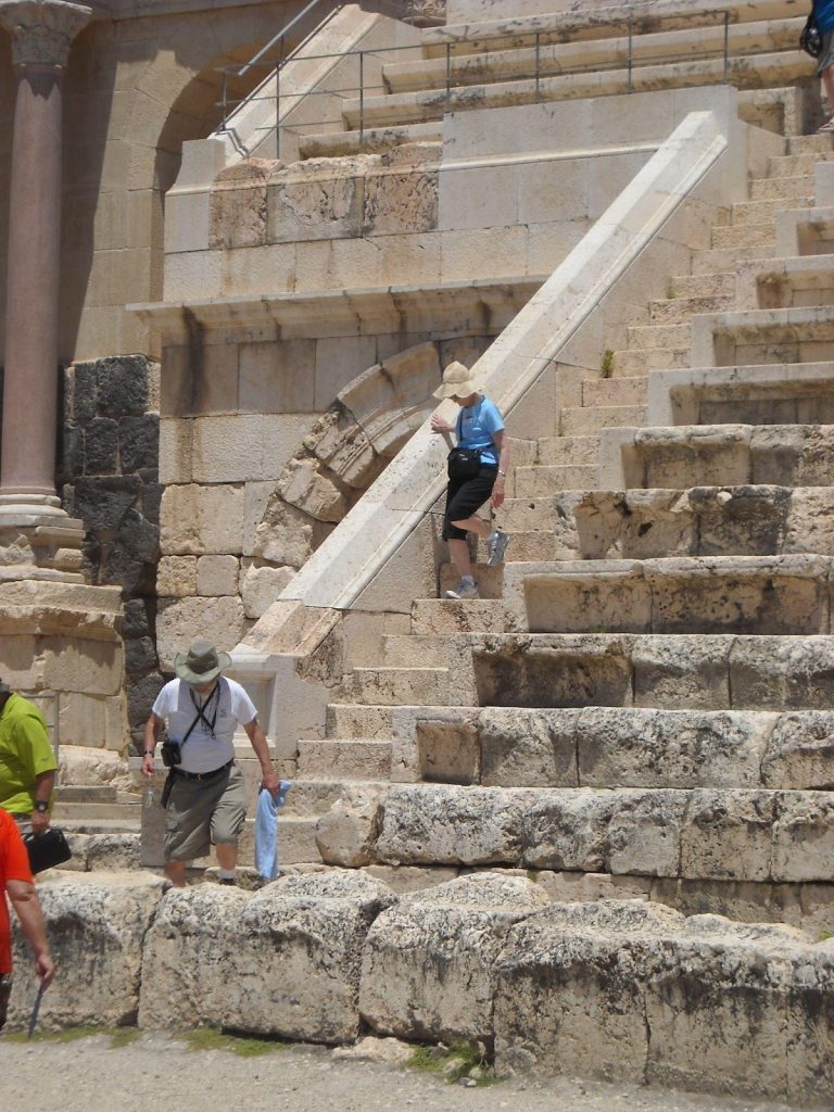
What we walked into is something I’d expect to see in Greece or Italy. It was a complete auditorium, minus a roof. It would rival many high school football stadiums…it was that big (about 2,000 seats)!
In addition to the theater, this city also had an amphitheater (a circular arena), a hippodrome (an arena for horse or chariot races), a public latrine (bathroom), and an elaborate bath house. Another feature that I recall vividly is called an Agora, which is a main street or plaza that would have had shops along it. Agoras are typically lined with columns, and this one is!
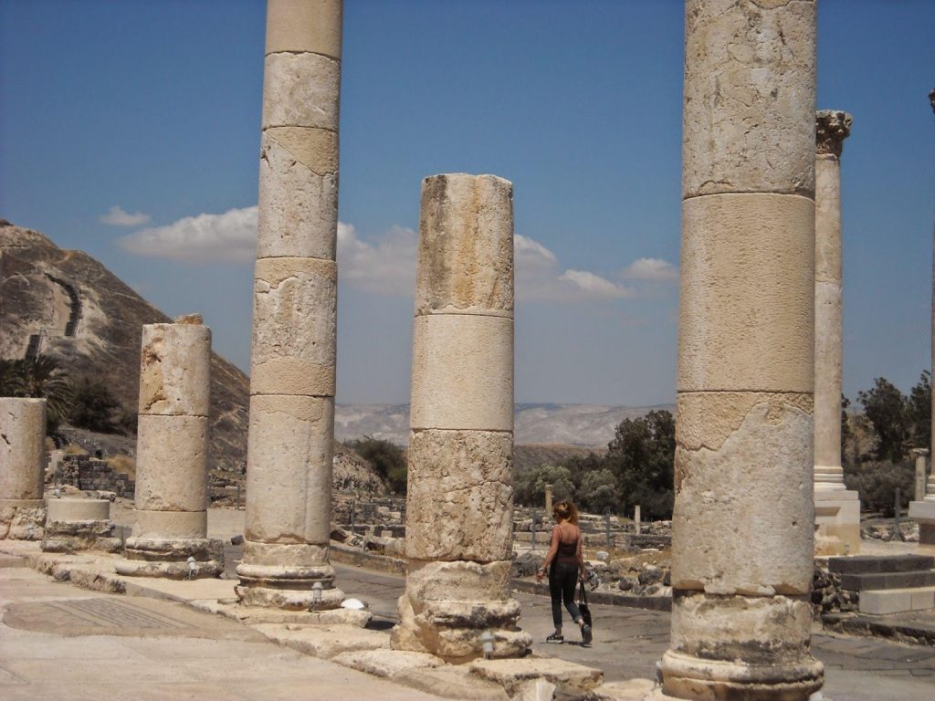
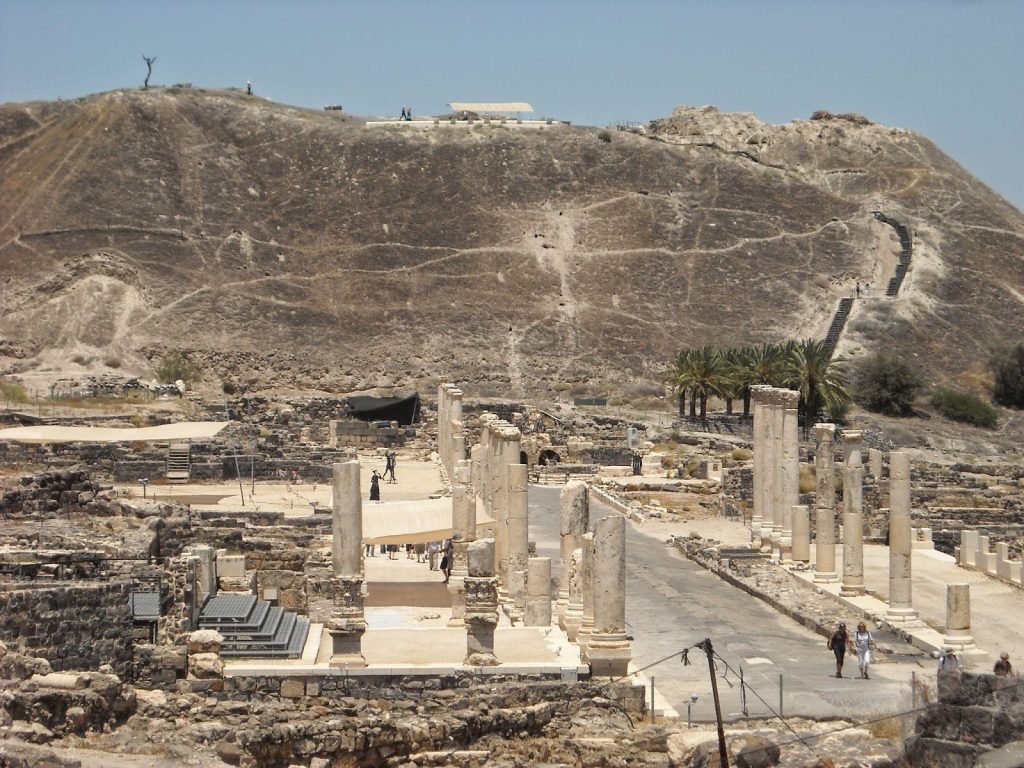
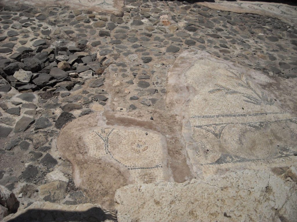
Finally, some of its roads are still fairly (and impressively) intact and include artwork!
Concluding the Tour
Before we leave Beth Shean, we need to acknowledge how significant its Roman influence would have been in Jesus’ day. The Decapolis cities would have been settled by Romans who embodied all of the Roman culture while absorbing some of the local pagan practices. These practices would have included the killing and eating of “unclean” animals, like pigs, which would never have been found in Jewish cities. Their religious beliefs included a huge pantheon of gods (think back to high school English classes–Zeus, Hera, Athena…), so the Romans dismissed the Jewish monotheistic idea as outdated. Add to all these cultural clashes the local pagan practices of Baal worship and child sacrifices and we begin to understand why Jews abhorred everything the Decapolis represented. No good Jew would have entered this region, yet Jesus does so quite intentionally.
We come to the end of our tour with some cultural knowledge which helps us better understand Jesus, His words and teachings, His intent, and His audience. That cultural context also aids our spiritual growth–because now we know how to ask better questions of the Text as we read it. What questions do you have now?
